
© BioConsult SH
APIS – Aerial Photogrammetric Integrative Surveys
In the APIS project, drone-based species and habitat mapping is tested in the Wadden Sea National Park.
Further information on possible applications for drones can be found in our description of the service.
What are the benefits of using drones in surveys and mapping in the Wadden Sea?
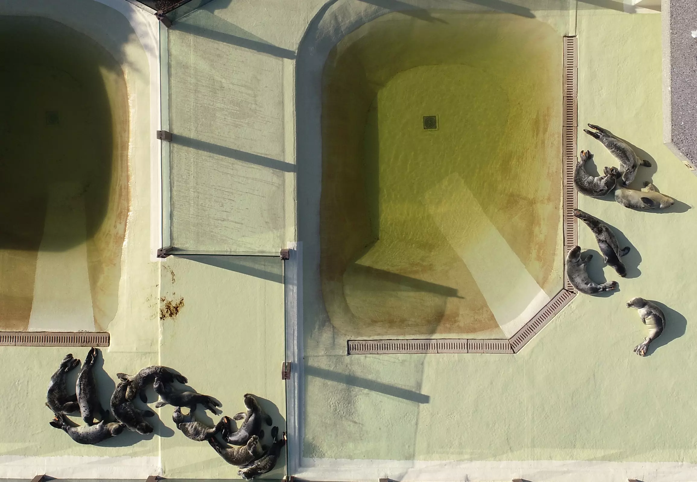
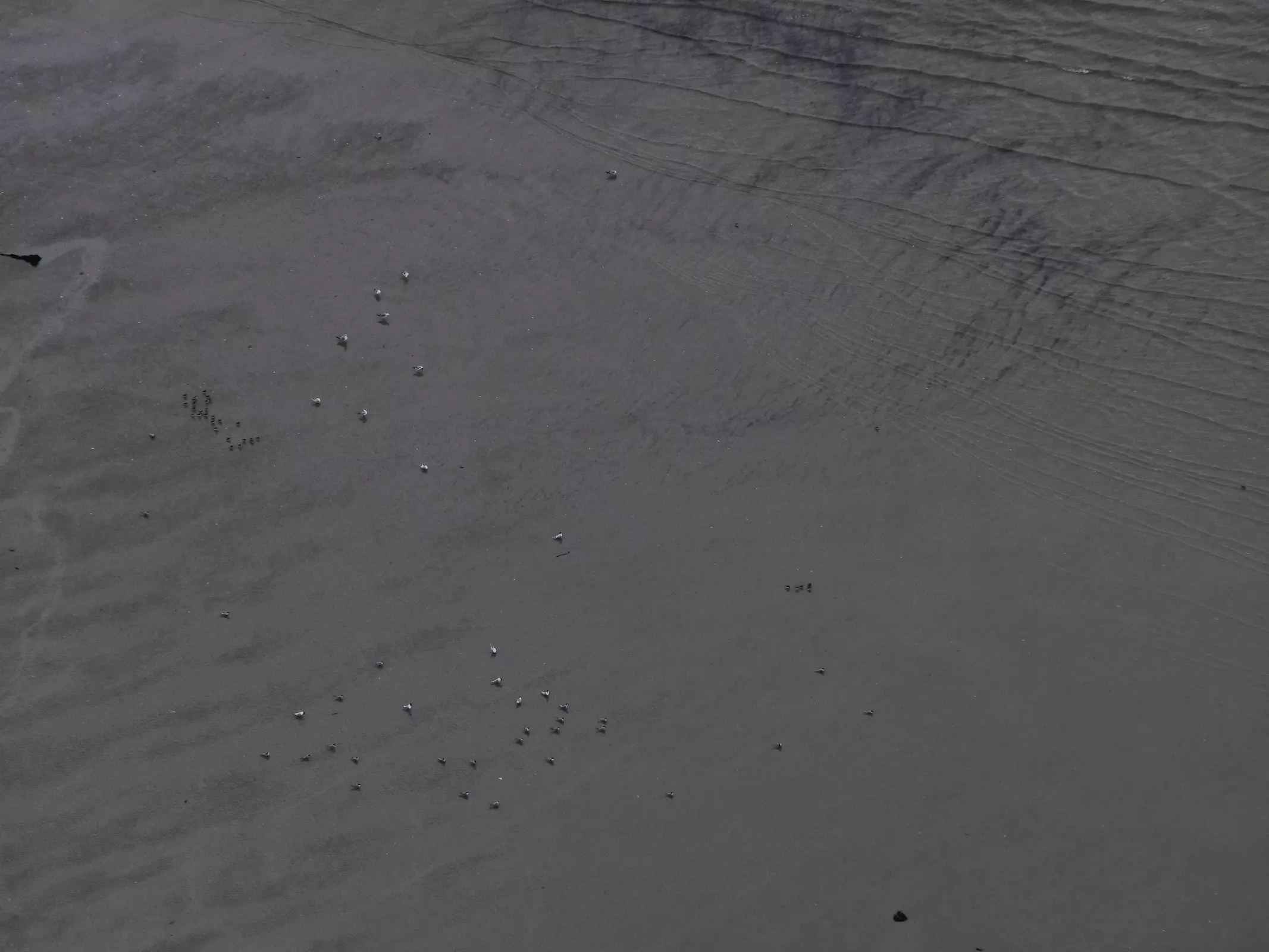
Use of drones allows capturing timely, high-resolution aerial photographs. During surveys in the Wadden Sea, drones may increase the accuracy of counts of birds or seals by at the same time avoiding disturbances caused by the observer.
The APIS project investigates possible applications for drones in surveys of various species and habitats in the Wadden Sea and possible impacts on the animals.
Aim of the project
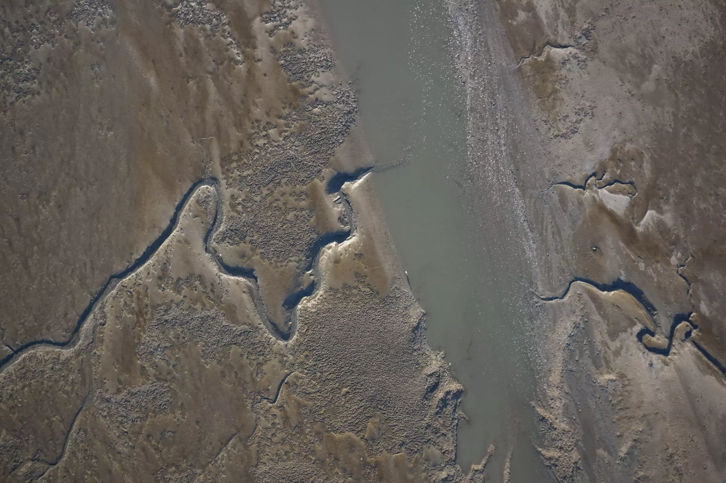
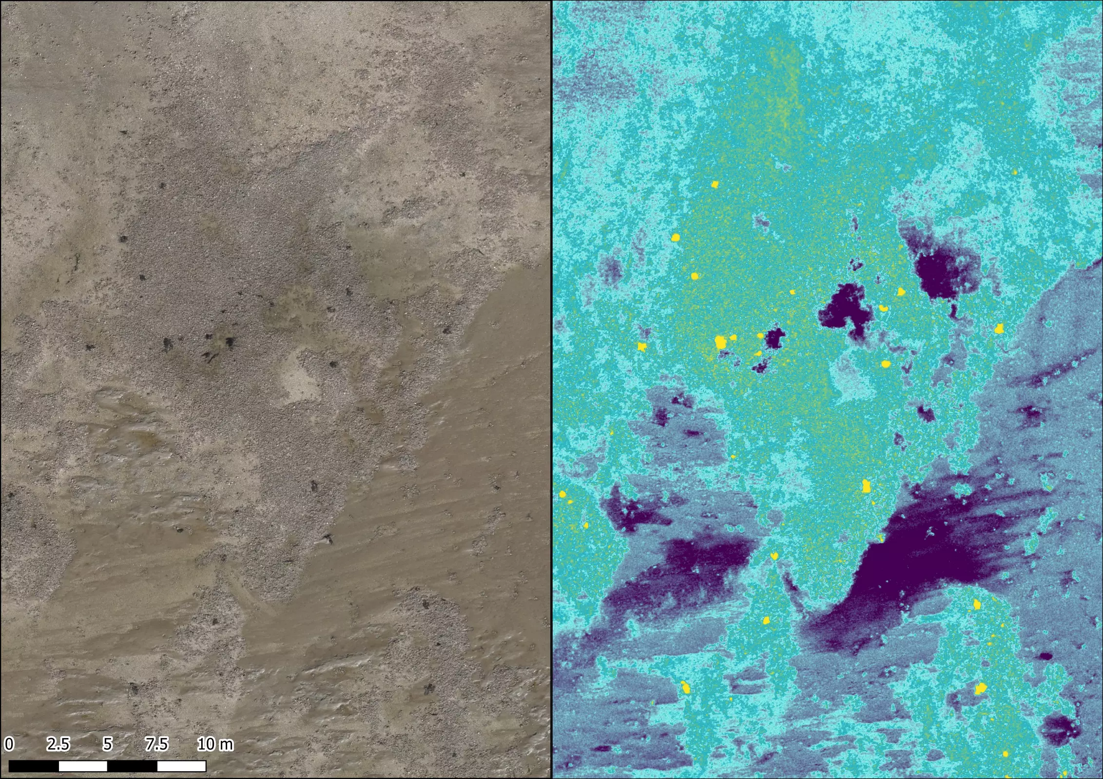
Aim of the APIS project is to test drone-based species and habitat mapping in the Wadden Sea National Park. Resting and breeding birds, seals, mussel and seagrass meadows will be mapped using drones and evaluated applying methods of machine learning and automatic image recognition.
The results of the image analysis will be compared to results of traditional survey methods and can be used to validate single methods. Further questions to be answered are which monitoring parameters can be captured using drones and which not and if drones will provide additional information in comparison to traditional methods.
Next to tests of drone-based species and habitat mapping, possible behavioural reactions of birds and seals to drones will be systematically recorded and evaluated.

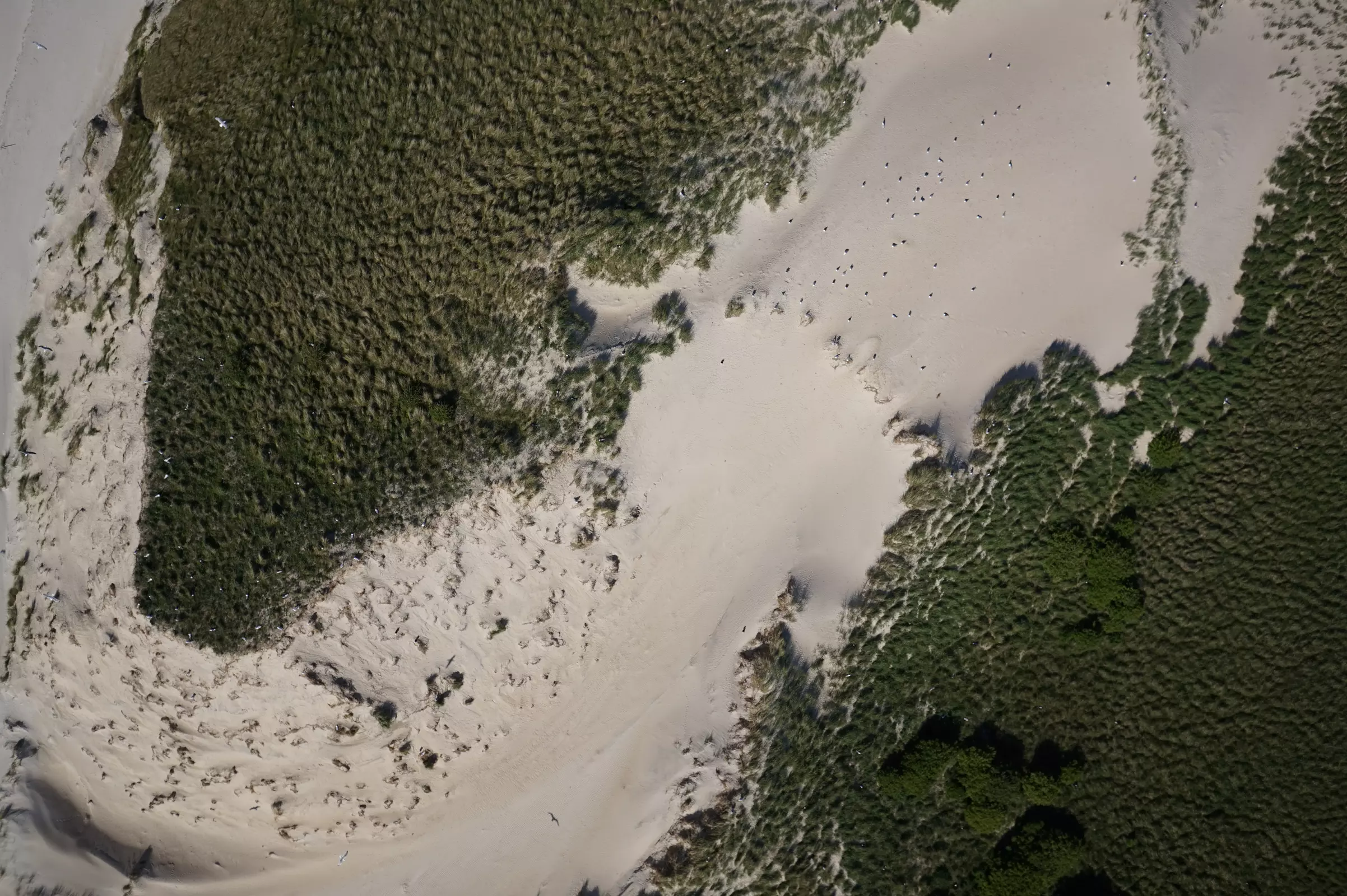
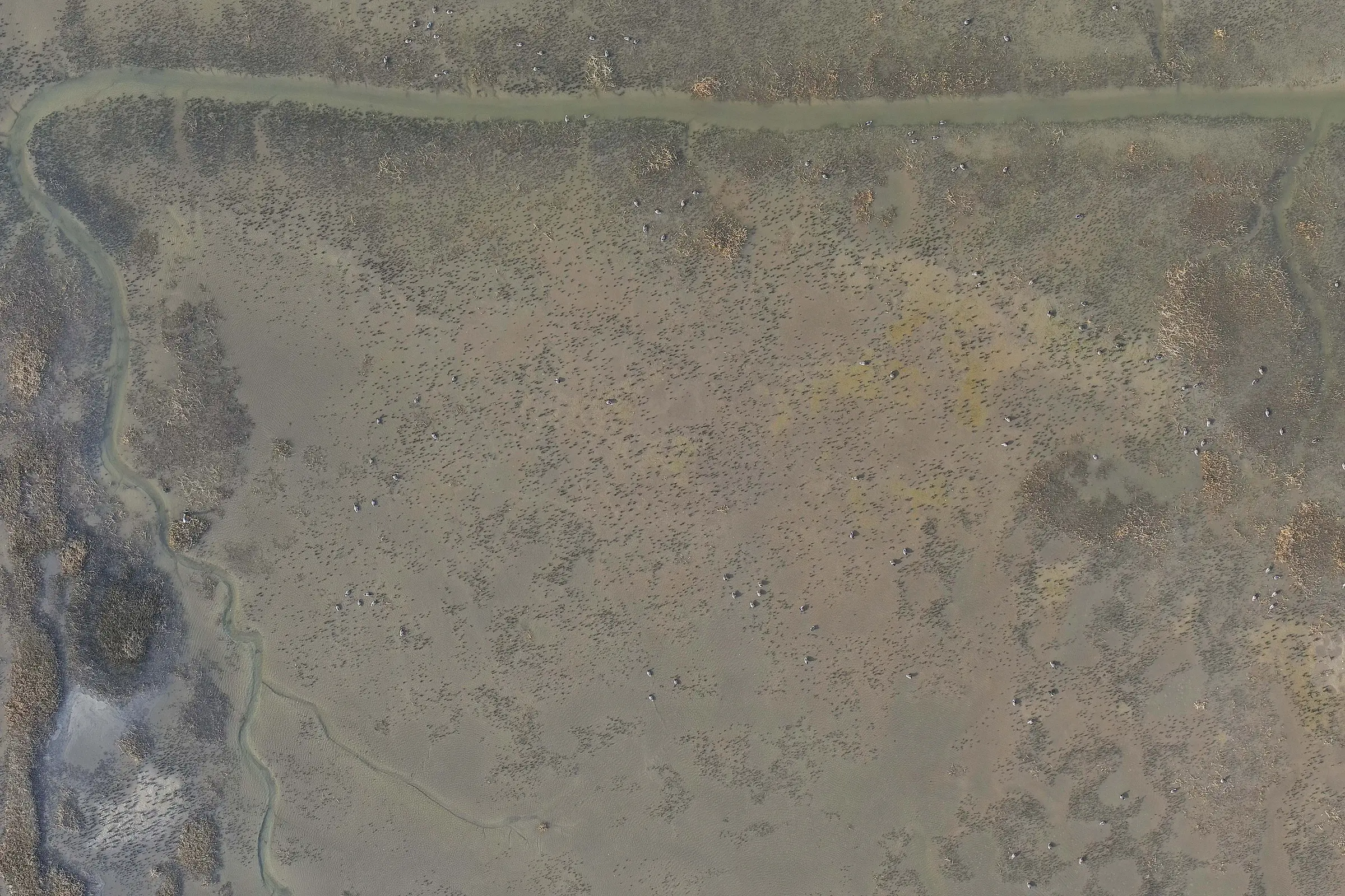
© BioConsult SH
Aerial photograph of a colony of gulls in the intertidal zone of a North Frisian island.
Methods
The drone-based surveys are carried out over a period of two years using a fixed-wing (WingtraOne GEN II) and two multikopter (DJI Matrice 300 RTK, DJI Phantom 4 Pro) drones capturing images with RGB and multispectral sensors.
The recorded images are processed and prepared for automated habitat classification and animal detection. A comparison between traditional methods of machine learning and methods of automatic image recognition will be carried out. The results of both methods will be validated against reference data recorded in the field.
Subsequently, the drone survey results will be compared to results of traditional field mapping to show whether and how drone surveys can complement existing monitoring concepts.
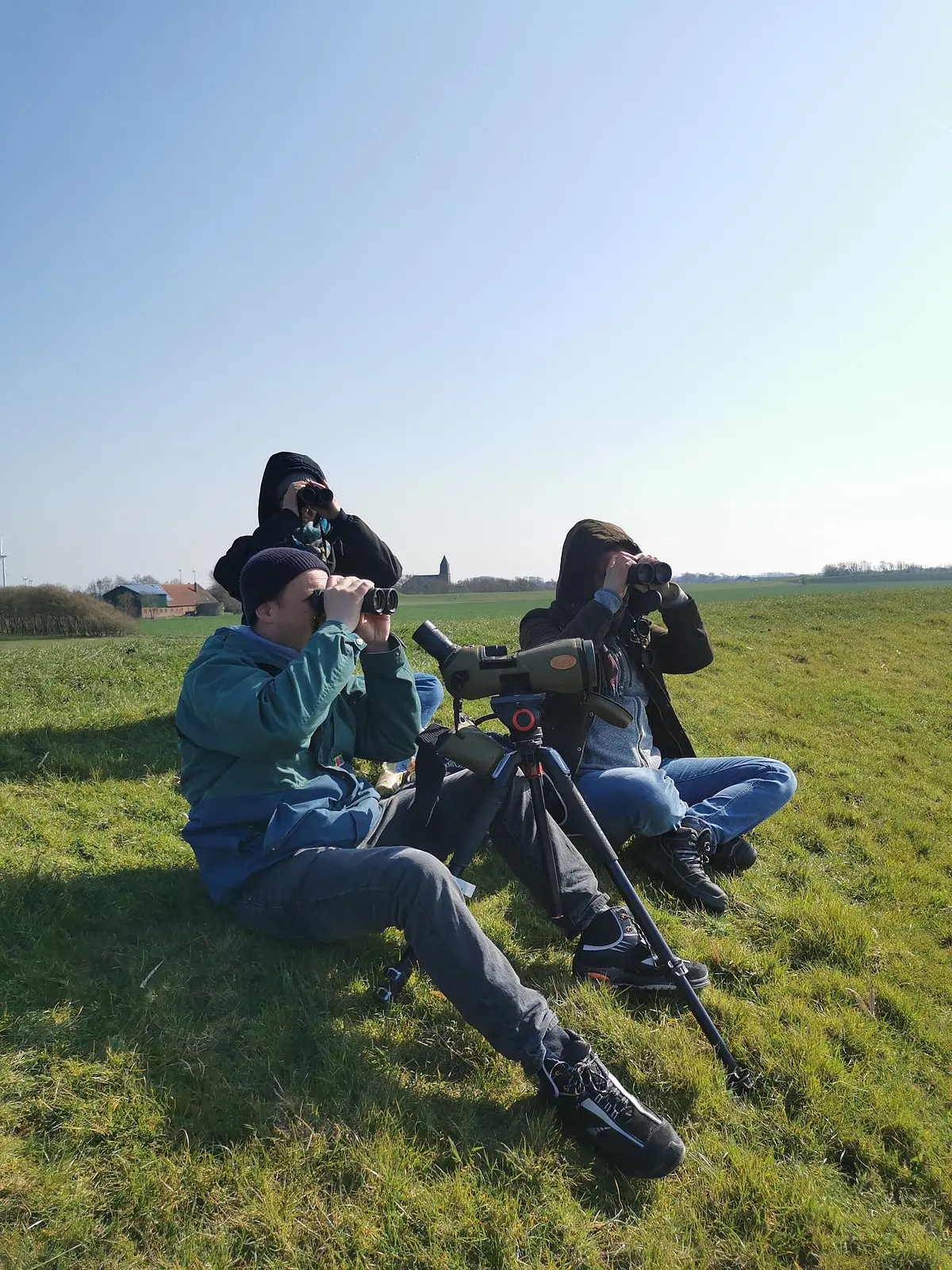
Experts monitor behavioural reactions of birds and seals to drones. They record the behaviour of the animals in reference periods prior to, during and after a drone survey. The applied disturbance monitoring protocol is a BioConsult SH development and has already been used in breeding bird surveys over the past three years.
Further information
Michael Kurowski and Justus Hamberger, graduates of RheinMain University of Applied Sciences, accompanied our drone team in the summer of 2024 while mapping a mussel bed. The resulting documentary film provides an insight into the civilian use of drones. Their use in the APIS project can be seen from 7:05 onwards.
The magazine "Drones" published a report on the project in its 03/24 issue (in German).

VOGELPERSPEKTIVE - Drohnengestützte Art- und Habitatkartierungen im Nationalpark Wattenmeer
Drones, Ausgabe 03/2024
The APIS project is carried out in cooperation with the Wadden Sea Conservation Station, Seal Centre Friedrichskoog and the Alfred Wegener Institute (AWI).
Further information can also be found on the website of the UAM-InnoRegion-SH (in German).
Funding period
2022 to 2024
Funded by
APIS is a pilot project of UAM Inno Region SH (WIR! Bündnis) and is funded by the Federal Ministry of Education and Research (BMBF).
Partner
Fachhochschule Westküste – University of Applied Sciences, Heide

