

© C. Groß
Aerial wildlife monitoring
Combining thermal infrared technology, high-resolution visual cameras and flexible study designs, we survey wildlife efficiently across large areas and with a clearly defined spatial reference from the air.
Data for wildlife management and ecology
Reliable information on population size, distribution and habitat use provides an important basis for sustainable hunting and forest management, nature conservation, monitoring and research. Regular surveys help identify changes in (hoofed game) populations and habitat development, while supporting planning of management measures and assessing their effectiveness.
Standardised IR-VIS aerial surveys for population assessment and habitat use
Standardised IR-VIS aerial surveys (infrared and visible spectrum) enable large-scale wildlife surveys, including hoofed game such as red deer, fallow deer, roe deer and wild boar, even in areas that are difficult to access or where visibility is limited.
We combine thermal infrared data with high-resolution visual imagery acquired from the air. Thermal imagery enables reliable detection of animals, while visual imagery supports accurate species identification.
Our aerial wildlife surveys are suitable for:
- large-scale wildlife monitoring,
- population and density estimates,
- repeated surveys to analyse changes in population size and density over time,
- analysis of spatial distribution patterns and habitat use,
- interpretation of complementary data, such as hunting yield statistics,
- evaluation of the effectiveness of management and conservation measures,
- planning, monitoring and research projects.
We support you in developing the most appropriate study design for your project.
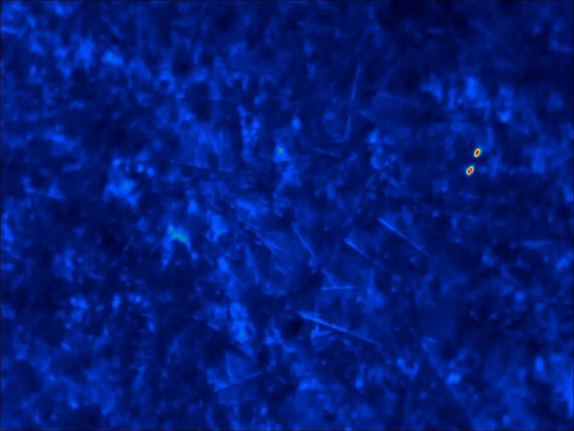
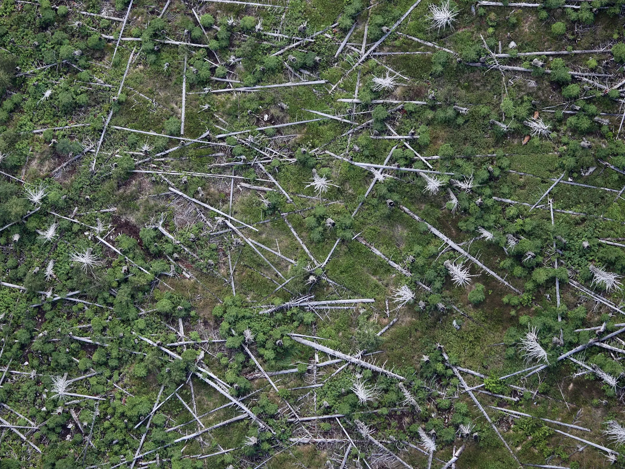
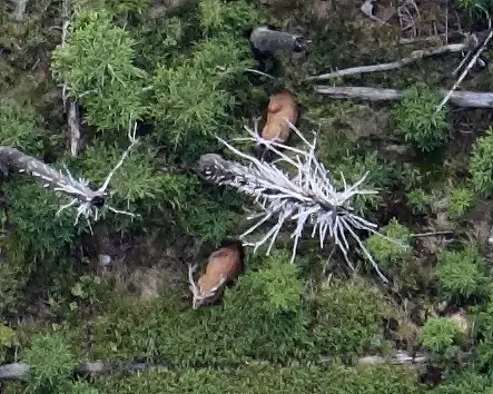
The combination of thermal infrared data and visual images ensures accurate detection. The thermal imaging data enables reliable detection of the animals, whilst the visual data aids in species identification (in this case, red deer).
From detection to spatial analysis
Flight altitude and camera parameters provide a clearly defined spatial reference for the imagery. This allows us not only to document wildlife occurrence, but also to estimate population densities and abundance.
At the same time, the high spatial resolution of the data provides valuable information on the distribution of animals and their use of different habitats.
For robust population estimates across different vegetation structures, we account for cover-specific detection probabilities. This allows differences in detectability to be incorporated methodologically and provides more reliable estimates of wildlife populations.

Flexible aerial surveys and long-standing expertise
We conduct our aerial surveys in close cooperation with Ulrich Franke. For two decades, he has been surveying wildlife from the air using thermal infrared technology and high-resolution cameras. Since summer 2026, his business unit wildlifemonitoring by aerosense has been part of BioConsult SH.
His extensive technical and methodological experience in aircraft-based wildlife monitoring complements our expertise in remote sensing.
Our cooperation focuses on the joint development and technical advancement of survey and analysis methods.

© U. Franke
Aerial surveys provide high-resolution spatial data on the distribution of the animals and their use of different habitats.
Complementary geospatial data from drone surveys
In addition, we can generate high-resolution geospatial data using drone surveys. These provide detailed spatial representations of the study areas.
The resulting data can be used, for example, to analyse habitat use, vegetation structures and other spatial relationships, providing a basis for further analyses and research questions.

